google-site-verification: google1c6a56b8b78b1d8d.html Adena Hopewell Mound Builders in the Ohio Valley: map
Showing posts with label map. Show all posts

Monday, June 10, 2019

Archaeological Map of the Burial Mounds in Noble County, Indiana

Archaeological Map of the Burial Mounds in Noble County, Indiana


About  30 burial mound sites were physically investigated in Noble County, Indiana.  Many of these sites required 3 or 4 visits before getting access o the land.  A few burial mounds were photographed that had no historic provenance but were shared with me because all I desired was to take a photo for posterity.  Many landowners shared that they had held information back about mound sites and skeletal remains being found from archaeologists because they knew that they could seize their land or destroy any mounds that were on their property. In the end, 8 mound sites were photographed and the directions provided in "The Nephilim Chronicles: A Travel Guide to the Ancient Ruins in the Ohio Valley."

Friday, September 14, 2018

An Archaeological Map of the Location of Iroquois Indian Burial Mounds in Noble County, Indiana

An Archaeological Map of the Location of Iroquois Burial Mounds in Noble County, Indiana

36 burial mound sites were investigated in Noble County.   7 of these ancient burial mound sites can still be viewed today. Nothing is preserved or even recognized as a historic site. The mounds could date from 2000 B. C. -1200 A.D. Numerous remains were found, making it the most abundant County in Indiana of prehistoric remains. Discover ancient Indiana with all the photos, directions, and historical documentation.


Monday, March 14, 2016

Map of Historic Tribes of the Hopewell Mound Builders

Map of Historic Tribes of the Hopewell Mound Builders


This map shows the historic Indian tribes that made up the Hopewell Empire. The Sioux, Cherokee, and Iroquois are believed to have been the earlier Maritime Archaic and split about 1500 B.C. Linguistic studies show these three historic tribes to have a similar language that was from a common tongue.  History of the early Native American mound builders

Thursday, November 27, 2014

Ohio Adena Hopewell Burial Mound Map

Ohio Adena, Hopewell Burial Mound and Earthwork Map

This is a partial map of the general location of many of the Adena Hopewell mound and earthworks.
This was originally made for "The Nephilim Chronicles: A Travel Guide to the Ancient Ruins in the Ohio Valley," but I thought it was a little "busy" and I was having trouble finding a spot to put all of the sites.

Friday, February 14, 2014

Archaeological Atlas and Photos of the Ancient Mounds in Brown County, Ohio

Photos of the Ancient Mounds in Brown County, Ohio

The ancient remains of Brown County are chiefly mounds, enclosures and cists.  It cannot be said that any law governing the arrangement or distribution of these works has been discovered. They are, perhaps, most numerous in the valleys near the Ohio, but they are found on the flat lands in the north of the county, and also on the most inaccessible places. A small mound is situated on the summit of the hill called Bald Point, near Georgetown.


Small Adena burial mound near Georgetown in Brown County, Ohio


 Two mounds near the Ohio, not far from Aberdeen, are the largest in the county. The purpose for which the mounds were built is unknown. They may have been surmounted with houses and approachable only with ladders, or foundations for watch towers and signal stations, or places of worship and sacrifice. A more common view is that the mounds were places of sepulture and memorials raised over the dead  the largest mounds being erected in honor of distinguished personages. 

Sepulchers for Ohio's Giant Race.
The History of Brown County, Ohio, 1883
Mastodonic remains are occasionally unearthed, and, from time to time, discoveries of the remains of Indian settlements are indicated by the appearance of gigantic skeletons, with the high cheekbones, powerful jaws and massive frames peculiar of the red man, who left these as the only record with which to form a clew to the history of past ages.


One of Ohio's largest Adena burial mounds is located in Brown County, Ohio.  It is currently being obliterated for a few bushels of corn.


About a mile to the west from the last mound is this smaller sepulcher.


Adena burial mound overlooking the Ohio River in the town of Aberdeen. The mound is not preserved not marked and is left overgrown in the summer months.


Arched stone tombs, many times contained the remains of giant humans.


The notion that they contain the remains of vast heaps of dead fallen in great battles is wholly unsupported by the facts obtained from excavations and examinations. But one or two skeletons are usually found in these mounds, and where many are found, it is probable that the later Indians, and, in some cases, Europeans, have buried their dead in them. The new American Cyclopedia assumes, from facts and circumstances deemed suflicient to enable us to arrive at approximate conclusions concerning the antiquity of the Mound-Builders’ records, that we may infer, for most of those monuments in the Mississippi Valley, an age of not less than 2.000 years. “ By whom built, whether their authors migrated to remote lands under the combined attractions of a more fertile soil and more genial clime, or whether they disappeared beneath the victorious arms of an alien race or were swept out of existence by some direful epidemic or universal famine, are questions probably beyond the power of human investigations to answer. History is silent concerning them, and their very name is lost to tradition itself.” The inclosures, which seem to have been works of defense, and are commonly called ancient forts, in Brown County are not numerous or important. 


Small irregular stone mounds were also found in Brown County that mark the graves of the ancient Shawnee under the archaeological guise of the Ft. Ancient peoples.

There are several prehistoric cemeteries in this county, and in some of them a number of skeletons have been found, and frequently implements in connection with the skeletons. The bodies were usually placed in shallow graves, on the sides and ends of which were placed stones on edge, forming a stone box or cist. It has been doubted by some whether these graves are as ancient as the mounds. They were found both in the northern and southern part of the county, but they attracted the  most attention at the mouth of Eagle Creek. James Finley, Postmaster at West Union, on February 1, 1809, wrote: “Graves are found in different parts of the county. The bodies are deposited in sepulchers made by digging the grave about three feet wide and walling it up with flat stones. The small bones crumble to dust when touched; the large ones are yet sound. Several of these graves are on the bank of the Ohio just above Eagle Creek. The bank has fallen away, and they appear like the end of a conduit made for the conveyance of water.” The archaeological remains of Brown County are not so numerous or extensive as those of Ross, Pickaway and Warren Counties; yet here,as in almost the whole of the Ohio Valley, are found traces of a numerous and busy ancient and now extinct race, not of nomadic tribes, but tillers of the soil, workers in copper mines and builders of extensive towns and works of defense—a people with fixed laws, customs and religious rites. Many of the prehistoric works of the county have been obliterated by the cultivation of the soil, and few of them have been accurately surveyed and described. The ancient remains of other counties in Southern Ohio have attracted more attention from writers on American antiquities than any in Brown. 


Thursday, February 13, 2014

Ashland County, Ohio Burial Mounds And Earthworks

Ashland County, Ohio Burial Mounds And Earthworks

Archaeological Map of the Burial Mounds and Earthworks in Ashland County, Ohio

ASHLAND COUNTY. 

Ashland county is remarkable among the northern counties 
of the state for the comparatively large number of earthen en- 
closures it contains. Most of these enlosures are quite small, and 
are both the circular and elliptical, and the rectangular type. 
Green township in particular is rich in these enclosures, while 
Mohican township also contains a number.


 The abundance of earthworks in southern Ashland County 
possibly may be due in part to the fact that the Great Trail passed 
through this section, crossing the headwaters of the Mohican river 
and the numerous streams tributary thereto. Numerous burials, 
old village sites, etc., together with the many stone implements 
found show that southern Ashland county was a scene of consider- 
able activity in aboriginal times. 

Wednesday, January 22, 2014

Scioto County, Ohio Archaeological Atlas

Scioto County, Ohio Archaeological Atlas
Mounds and earthwork locations in Scioto County, Ohio


Friday, May 3, 2013

Map of Indian Burial Mound Sites in Eastern North America

Map of North American (Indian) burial mound sites

Map showing the location of Indian and Ancient Indo European burial mounds

Thursday, January 3, 2013

Ohio's Serpent Mound Visitors Guide

Ohio's Serpent Mound Visitors Guide


The Century Illustrated Monthly Magazine
November 1889 - F. W. Putnam
      In September, 1883, in company with four fellow-archaeologists, I started from Hillsborough, in Highland County, Ohio, on an excursion to several ancient earthworks which we had long wished to see. Our plans were so arranged as to take us first of all to the Serpent Mound, thence to Fort Hill, and down Paint Creek to the Scioto, stopping from day to day to visit the most interesting of the many ancient works along the route.

Serpent Mound from below on Brush Creek.  This uplift was caused by a meteor hitting this spot millions of years ago.


      Approaching the "Serpent Cliff" by fording Brush Creek from the west, our attention was suddenly arrested by the rugged overhanging rocks above our heads, and we knew that we were near the object of our search. Leaving the wagon, we scrambled up the steep hillside, and pushing on through bush and brier were soon following the folds of the great serpent along the hilltop. The most singular sensation of awe and admiration overwhelmed me at this sudden realization of my long-cherished desire, for here before me was the mysterious work of an unknown people, whose seemingly most sacred place we had invaded. Was this a symbol of the old serpent faith, here on the western continent, which from the earliest time in the religions of the East held so many peoples enthralled, and formed so important a factor in the development of succeeding religions?

     Reclining on one of the huge folds of this gigantic serpent, as the last rays of the sun, glancing from the distant hilltops, cast their long shadows over the valley, I mused on the probabilities of the past; and there seemed to come to me a picture as of a distant time, of a people with strange customs, and with it came the demand for an interpretation of this mystery. The unknown must become known! This thought took complete possession of me, and on that same evening arrangements were made with Mr. Lovett, the owner of the land, to have the place cleared of underbrush that we might see the great work in its entirety. By noon of the following day the clearing was roughly made, and the view thus obtained of the serpent and the egg as the oval work in front of its jaws has been called led to a still stronger desire to know more, and a resolve to do all in my power to preserve this singular structure, which seemed so strangely transplanted from the mythology of the East.

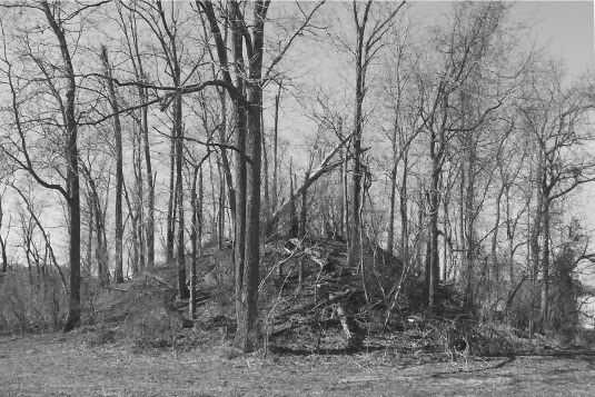
     When Squier and Davis, after their survey in 1846, gave to the world the first account of this earthwork, it was covered with a thick forest, from which many a noble tree has been cut, as indicated by stumps still standing at the time of our visit. Thirteen or fourteen years after their visit a tornado swept its path directly along the serpent hill, and with the exception of a few saplings the forest was laid low. This led to clearing the land, and to the cultivation for a few years of the portion occupied by the serpent. Nature soon covered the scars with a protecting sod, which was followed by a growth of sumach, redbud, and briers.
, 1-The Oval Embankment in front of the serpent's mouth. In this inclosure is a small mound of stones. 2, The Serpent. 3, A low Artificial Mound near the head of the serpent. 4, A very small Artificial Mound just west of 3. 5, 6, 7, Ancient Excavations, appearing like sink-holes. 8, 19, 20, 21, 22, 23, 24, and in space bordered by 18, 15, 20, 21, are Sites of Ancient Habitations. 9, Burnt Stones on the clay. 10, A recent Indian Grave over two graves. 11, Portions of Three Skeletons in a pile. 12, 13, Skeletons in the clay. 14, Grave with Two Skeletons. 15, Grave with Skeleton, over which was an ash bed. 16, Pieces of a large Clay Pot. 17, Small Burial Mound. 18, Several small Excavations in the clay, filled with dark earth. 19, 24, See above. This Village Site was afterwards found to extend 200 feet east and south. 25, Burnt space under the dark soil extending to the edge of large conical mound. 26, The Conical Mound, a monument over a single body. 27, 28, Cremation Places in the clay under the dark soil. 29, 30, 31, Very Ancient Graves deep in the clay. 32, Small Mound over four ancient graves in the clay.

       Following a graveled path winding up the hill from the picnic grove to the plateau, the first point of archaeological interest is reached. This is a conical mound nine feet high and seventy feet in diameter (26). Northwest of this, and not far from the serpent, is an old burial place which was afterwards the site of a village (8, 19), as shown by the ash beds, the many implements in various stages of manufacture, the many thousand chips of flint and other stones foreign to the locality, and the many potsherds and other objects scattered throughout the dark soil. A small mound (17), about a foot high, west of the path leading from the road to the serpent, and a few stones (10) nearer the path, mark the position of the cemetery, and all about there skeletons have been found in the dark soil or in the clay below it.
     On the south side of the park road, on one of the projecting points of the plateau, now marked by several piles of stones (27-31) which were taken from around the graves in the clay below the soil, were graves of the first period of occupation. On the knoll west of this, over which a wild cherry tree now casts its shade, is a low oblong mound (32), a monument over four ancient graves. From this knoll, looking towards the setting sun, there is a grand view of the valley and the hills beyond; and standing on this spot one can readily imagine why it may have been chosen as the burial-place of the honored among a people whose sacred temple was near by.
     North of this knoll, on the declivity from the plateau to the cliff, are three circular pits, varying in size; and much of the clay used in building the effigy of the serpent was probably taken from these places.
       Following the ridge of the hill northerly to the overhanging rocks, one is forced again to pause and admire the scene before him the beautiful hill-girt valley with its acres of waving corn; the silvery line of the river with giant sycamores and graceful elms along its banks; and the vistas opening here and there, where the broader and deeper portions of the river are bordered with dark-green undergrowth, brightened by gleams of rich color.
Turning from this view, and ascending the little knoll behind the ledge, eighty feet from the edge of the cliff is the western end of the oval figure (1) in front of the serpent's jaws. This oval is one hundred and twenty feet long and sixty feet in greatest width, measured from the outer edge of the bank, which is about four feet high and eighteen feet across. Near the center of the inclosed area is a small mound of stones, which was formerly much larger, since it was thrown down over fifty years ago by digging under it in search of supposed hidden treasure, the popular belief which has caused the destruction of many an ancient cairn. Many of the stones show signs of fire, and under the cliff are similar burnt stones which were probably taken from the mound years ago; for I have been informed by an old gentleman, who remembered the stone mound as it was in his boyhood, that many stones taken from the mound were thrown over the cliff.
     This portion of the hill was either leveled off to the clay before the oval work was made, or there was no black soil upon the hill at that time, as none was used in the construction of the embankment, nor left below it. The same is true of the serpent itself. Careful examination of several sections made through the oval and the serpent, as well as laying bare the edge along both sides of the embankments throughout, have shown that both parts of this earthwork were first outlined upon a smooth surface along the ridge of the hill. In some places, particularly at the western end of the oval, and where the serpent approached the steeper portions of the hill, the base was made with stones, as if to prevent its being washed away by heavy rains. In other places clay, often mixed with ashes, was used in making these outlines; and it is evident that the whole structure was most carefully planned, and thoroughly built of lasting material.
The geological formation of the hill shows first the ledge rock, upon which rests the decayed grayish rock forming the so-called marl of the region, the upper portion of which has by decomposition become a grayish clay. Over this lies the yellow clay of the region, filling in all irregularities, and varying in thickness from one to six feet. Upon this rests the dark soil of recent formation, from five inches to nearly two feet in thickness in different parts of the park. It is necessary to have this formation constantly in mind, as we must, to a certain extent, rely upon it in determining the antiquity of the works and burial-places.
Upon removing the sod within the oval the dark soil in the central portion was found to be nearly a foot in depth, where it must have formed after the oval work was built. How many centuries are required for the formation of a foot of vegetable mold we do not know; but here, on the hard gray clay forming the floor of the oval, was about the same depth of soil as on the level ground near the tail of the serpent, where it has been forming ever since vegetation began to grow upon the spot. The same results were obtained on removing the soil from the triangular space between the serpent's jaws; and that there was about the same amount of soil on the embankments is shown by the fact that the several plowings had not disturbed the underlying clay of which the embankments were constructed. The accompanying section through the western end of the oval illustrates this point.

Cross-section of the Serpent Mound.  The Serpent was made to last for thousands of years with it's rock base covered in clay.  This same method of construction of earthworks is found at other sites throughout Ohio.

       Nine feet from the eastern end of the oval, and partly inclosing it, is a crescent-shaped bank, seventeen feet wide. From the extremities of this crescent, which are 75 feet apart, begin the jaws of the serpent, formed by banks 17 feet wide and 61 and 56 feet, respectively, in length, measured on the inside from the point of union with the crescent to their point of meeting, 47 feet from the convex or eastern edge of the crescent. We must here notice that the open jaws are shown as if the serpent's head was turned upon its right side, and the crescent embankment seems to have been designed to express this by uniting the open jaws across the mouth, indicated by the triangular space. This design was also carried out by making the northern or upper jaw the longer of the two. The head of the serpent across the point of union of the jaws is thirty feet wide and five feet high. From this point the neck extends eastward more than one hundred feet, with a slight curve to the north. Then begins what may be called the body of the serpent, making a graceful curve to the south, then winding to the east and north, then again to the south, and westward down the declivity of the central portion of the hill, where another graceful convolution is made up the opposite ascent to nearly the same level as the head; here it folds round in another full convolution, and the tail follows with a long stretch to the southwest, terminating in a triple coil.


Serpent links from “Mound builders”

Ohio's Serpent Mound Visitors Guide

http://moundbuilder.blogspot.com/2013/01/ohios-serpent-mound-visitors-guide.html

Origins of Ohio's Great Serpent Mound is in Scotland


Visual Tour of the Serpent Mounds in the Ohio Valley
http://moundbuilder.blogspot.com/2012/12/visual-tour-of-serpent-mounds-in-ohio.html


Large Stone Alter Reported Near Ohio's Famous Serpent Mound

Serpent Mound Discovered in Indiana


Serpent Effigy and Indian Fort Wisconsin

Possible Serpent Effigies in Waukesha County, Wisconsin

http://moundbuilder.blogspot.com/2012/02/possible-serpent-effigies-in-waukesha.html


Serpent Mound and Burial Mounds in Chicago, Illinois
http://moundbuilder.blogspot.com/2012/02/indian-burial-mounds-north-of-chicago.html


Adena Serpentine Enclosure in Hamilton County, Ohio

http://moundbuilder.blogspot.com/2011/11/adena-serpentine-enclosure-in-hamilton.html


Ohio Mounds: Adena Hilltop Serpentine Enclosure in Hamilton County

http://moundbuilder.blogspot.com/2011/11/ohio-mounds-adena-hilltop-serpentine.html


Serpent Mound in Peebles, Ohio and its Ancient Symbolism

http://moundbuilder.blogspot.com/2011/09/serpent-mound-in-peebles-ohio-ans-its.html

Wednesday, February 8, 2012

Indian Mounds and Earthworks Near Milwaukee Wisconsin


Indian Mounds and Earthworks Near Milwaukee Wisconsin
Map showing Indian Mounds Near Milwaukee Wisconsin

The relative position and extent of the earthworks in the vicinity of Milwaukee, will appear on reference to the map They extend from Kinnickinnic Creek, near the place known as the Indian Fields, to a point six miles above the city. It will be observed that they occupy the high grounds along the margin of the river and streams, but not on the immediate shore of the lake. Although the mound-builders often occupied the margin of the smaller lakes in the interior, they seldom or never selected the immediate shore of Lake Michigan for the site of their works.
[page 13:]The banks of rivers appear to have been their favorite localities; and in this respect they resemble the present Indians, who select sites commanding a view of the country around them (so as to be able to detect the first approach of an enemy), and near hunting and fishing grounds. They appear also to have had an eye for the beautiful as well as the useful, in choosing their places of abode.
From the same hills on which are found these mounds, the workmen, in grading streets, digging foundations for buildings, preparing terraces for gardens, &c., often disinter the skeleton of an Indian, with its accompanying ornaments, and perhaps his brass kettle placed at the head. A number of the skulls thus brought to light were sent to Dr. S. G. Morton, to be used in the preparation of his Crania Americana.1
1See that work, p. 179.

The bluffs along the Milwaukee River, on which these works are mostly situated, have an elevation of from 30 to 100 feet above the water. They are usually quite steep, though not so much so, except in one or two places, as to be precipitous.
There is evidence, drawn from the presence of deposits of fresh-water shells in layers of sand and gravel, that the waters of the lake at this place once stood at a level considerably above their present height; and at that time much of the site of the present city was submerged. The bluffs were then washed by the waters of the bay, and presented steep broken fronts. The banks were gradually undermined, and slides of considerable extent occurred precisely as is now seen on the present margin of the lake. Whether this subsidence was subsequent to the erection of the mounds, is uncertain, their situation being such as to throw no definite light upon the subject. There are no works below that level that can lay claim to great antiquity.
The ancient works about Milwaukee are most numerous at a place near the small creek called the Kinnickinnic, and on lands known as the Indian Fields. They are chiefly in section twelve, township six, and range twenty-one, town of Greenfield. When the country was first settled (in 1836), the place was destitute of trees, and exhibited signs of recent Indian occupancy and cultivation. The creek borders it on the south and west, and an extensive swamp on the north and east, thus separating it from the adjacent country, and rendering it secure from sudden surprise or attack, without the necessity of extensive works of defence. It will be observed, as we proceed, that similar circumstances were often taken advantage of by these careful people.
The fields lie at a considerable elevation above the bottom-lands of the creek, and are much broken and uneven in surface. The soil is loose, sandy, or gravelly, and could be easily worked by the rude instruments of the aborigines; which may have been an inducement for selecting this spot. The subsoil is gravel, to an unknown depth. The Milwaukee and Janesville plank road passes through the fields; and the wood land adjoining has been adopted on account of its gravelly soil, undulating surface, and beautiful forest-trees, as the site of a cemetery for the city, named appropriately the “Forest Home.” 

Wednesday, October 19, 2011

Adena Burial Mound Encircled with a Ditch is Photographed in Huntington County, Indiana

Adena Burial Mound Encircled with a Ditch is Photographed in Huntington County, Indiana

Historic Huntington County Map Showing the Locations of Burial Mounds in the County


Geological Survey of Indiana, 1875

Antiquities
        Though the present site of Huntington and the “Forks of the Wabash,” as the junction of Little River with that stream was familiarly called by the early settlers of the county, was the favorite abode of savages, yet, strange to say, no traces of the works of the prehistoric mound builder are found in the county, except along Salamonia River, in the southwest corner, opposite Warren, where, on a high eminence in the bend of the latter river, there are two mounds. The first one visit is at Daniel Adsits. It is about twenty-five feet in circumference and six feet high. A slight excavation had been made into the top, but so far as could be learned no relics were found. There is a shallow trench completely encircling it. From the top the view overlooks the Salamonia and its fine fertile bottoms. 
An Adeba Burial mound located in Warren Indiana in the Red Man cemetery.  The encircling ditch can still be seen around the mound. 

 The other mound is about a quarter of a mile to the northwest, and in a cultivated orchard belong to John D. Jones, and near his barn. This mound has been nearly destroyed by the plow, and I was unable to learn that it possessed any peculiar features, or contained any relics. Mr. Jones informed me that he had, from time to time, picked up on his farm, stone saxes, pipes, flint arrow and spear points, but could give no special account of the existence of other mounds. Though I followed Salamoni River for many miles above Warren, and made repeated inquiries about mounds, I could not learn of any others in the county.

Locals have also said that at one time mounds were located at the forts of the Wabash, however we were unable to find any evidence of this.

Saturday, October 1, 2011

Early Native American Indian Mound Builders Ruins in Lagrange County, Indiana

Early Native American Indian Mound Builders Ruins in Lagrange County, Indiana


Indian Burial mound map of Lagrange County, Indiana. The human figures represent large skeletons hat were found within the mounds. A graveyard in Lagrange County, Indiana of giant humans over 8 feet in height here  https://nephilimgiantsinnorthamerica.blogspot.com/2017/03/8-foot-human-giant-removed-from.html
Lagrange County map shows the locations of the burial mounds and earthworks in the county.  Each of these sites were investigated, with only one mound that was found.  This mound was not listed in any of the county histories, but was from a list given to me by Mr. McKibben who was head of the Historical Society for many years.  He thought that one of the mounds on the list was still extant, and had not wished to give it to university archaeologist who had been there earlier while doing an archaeological survey of the county.  He was afraid, and justly so, that university archaeologists would destroy anything they found.  The one mound that was found was coniclal in shape and encircled by a ditch.  The top had been removed by a local without permission, The mound was photographed but heavy rains made the picture quality poor and it was left out of, "The Nephilim Chronicles: A Travel Guide to the Ancient Ruins in the Ohio Valley."


History of LaGrange County
        Since it has been established that Northern Indiana, including LaGrange County, is rich in the remains of that mysterious people known as Mound Builders, it seems necessary to give at this point what is known of those people in this vicinity. The reader will fine in Chapter I, Part II, of this volume, complete classification of the Mound Builders’ works. Without attempting another such classification, the antiquities of LaGrange County, so far as known will be considered. I may be premised, that, from the fact that no military fortifications have been discovered in either of the two counties LaGrange or Noble, the territory was in the center of a large country of Mound Builders, and not on the border, or between two or more hostile tribes. Nothing has been found here, with one possible exception, save sepulchral, sacrificial and memorial mounds. Owing to the state of the weather, the historian has been unable (as was done in Noble County) to make a personal examination of the mounds of LaGrange County. However, many of those which were opened in the past by citizens of the county, who were generally careless in their examinations, have been made to yield up a portion of their secrets. A number of years ago, two mounds were opened on Section 13, Milford Township. A quantity of crumbling human bones were taken from one of them, among them being a skull quite well preserved. Some of the teeth were almost as sound as they ever were, and the under-jaw, a massive one, was especially well preserved. In the other mound was found a layer of ashes and charcoal, extending over two or three square yards of ground. This was undoubtedly a mound where sacrifices were offered to the deity of the Mound builders, and where burial rites with fire were performed. On the line between Sections 20 and 29, Springfield Township, is what might have been a fortification. The writer carefully examined the spot which is the summit of a gradual elevation; but, although Mr. George Thompson indicated the position of the alleged circular embankment, only slight traces of it were visible, and these were apparently much the result of speculation. It may have been, however, as the old settlers assert, Near the center of the level space on the summit was a large mound, at least five feet in height, in 1836. This was opened about that time, and from it were taken enough bones to indicate that more than one person had been buried there. It is said that a few trinkets, such as slate ornaments or mica were found. In the same township, about a mild northwest of this spot, are one large mound and perhaps a smaller one. These, it is said, have not been seriously disturbed. On Section 27, Clay Township; are two mounds, large ones, which have not been subjected to exhaustive examination. The writer has been told that there are three mounds in the eastern part of Lima Township, on the farm of George Shafer. Three-quarters of a mile northwest of Lima, on the Craig farm, are three mounds, which were opened a number of years ago. The usual bones and charcoal were found, as were also various trinkets, which may be seen in the private collections of curiosities of Lima. About forty rods west of James Moony’s house, in Van Buren Township, are three mounds, all of which have been opened. Human bones, slate ornaments and other trinkets were found, as was also an abundance of ashes and charcoal.  There are also mounds in the vicinity of Buck, Shipshewana and Twin Lakes. The peculiar formation about Wall and other lakes is due to the agency of ice. It is thought by some that the Indians or Mound Builders were responsible for the embankment, but no one familiar with formations of the kind will make such a declaration. Such walls are very numerous on the banks of Western lakes, especially those of Illinois and Iowa. Around some of the lakes of the latter State is a continuous chain of boulders and gravel, which, by observation through some thirty years, was undoubtedly thrown up by the united action of ice and waves, and the process of freezing and thawing. This fact is well understood and universally admitted by geologists, in Iowa. It may be added that were other evidences in the county of the presence in past years of Mound Builders aside from their mounds. Reference is made to stone or other implements or ornaments. W.H. Duff and Master George Dayton, both of Lima, and Dr. Betts, of LaGrange, especially the former two, have fine collections of antiquities. Mr. Duff has nearly 300 specimens, and Master Dayton has over 400. These consist mainly of stone axes, mauls, hammers, celts, mortars, pestles, flint narrow and spear heads, copper knives, and cooper arrow or spear heads, fleshing and skinning instruments, ceremonial stones, shuttles, and various other implements evidently used in weaving or sewing, colored slate ornaments, breast-plates of bone, ornamental charms and totems, igneous stones, many curious varieties of arrowheads and darts, etc., etc. There have also been found in the county an extremely rare slate or stone ornaments or implements, bone and metallic ornaments, small fragments of pottery, mica (not native), curiously carved pipes stone or other substance, besides other articles, the uses of which are extremely doubtful. Much more might be said in detail on the same subject.

Geological Survey of Indiana, 1874
     The section of high, undulating, lake-dotted country, of which Lagrange county is a part, does not seem to have been the home, or even the haunt, of any considerable number of the Mound Builders. One small earthwork is all that is known in the county; that is on Brushy Prairie, in the eastern part. It is about fifty feet across, nearly circular and raised two feet above the surface of the prairie; near the center is a small mound, about eight feet in diameter and three feet high. An excavation made, in this central mound, some years ago, exposed decaying human bones, some broken pottery and a few stone implements.
Early Lagrange County Plat map showing the location of the circular work.  Additional circular works were reported in Dekalb and Steuben Counties.  Next to Springfield is Brushy Prairie, where the smaller work was located.  Both of these sites were investigated with no remains of these earthworks found,

Annual Report of the Board of Regents of the Smithsonian Institution, 1879
       One mound, fifty feet base diameter, two feet high, near Brushy Prairie post office, human remains, potsherds, and flint implements about.