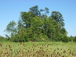
Demoret Adena Burial Mound in Butler County, Ohio
The largest mound of this group
must have been destroyed at some time, leaving this smaller mound of
the group as the only one to survive the urban sprawl. It is
situated next to a new home, however it has been left with thick
underbrush and trees growing on it that make it difficult to see.
The
Mound Builders, Archaeology of Butler County, Ohio,
1879:
On the farms of William Hogan and Charles Borger, section twenty-one,
is group of mounds, six in number. A plan of these given in Fig. 56.
The largest is
twenty-six feet high with a base eighty feet in diameter. The rest
vary in height, ranging from three to eight feet. The illustration
gives the relative sizes, positions and distances of the mounds
composing the group. The group is situated on the highest point of
land in the township, and from the summit of the largest mound a view
of the surrounding country can be obtained. To the east, if the
forest trees did not intervene, the city of Hamilton could be seen;
while to the south it overlooks the Colerain Hills.
Mr. L. Demoret
looked up the history of and the stories concerning this mound, and
writes as follows:
“About the year
1820 this mound was opened by a man named Young, assisted by the
Keever brothers, in hopes of finding a treasure chest. They worked
only during the hours of darkness, and in perfect silence, in the
belief that the chest never could never be reached if a word was
spoken while at work. A story was started, and believed by many,
that the chest was finally discovered, when one of the diggers
exclaimed: ‘I’ve got it at last!’ whereupon it slipped from his
fingers and vanished, leaving a smell of brimstone in the air.
“The tunnel was
started on the north side, about half way up the slope, and ran
downwards at an angle of thirty-five degrees, for a distance of
thirty feet, when the center was reached, from which point it was
carried eastwardly several feet. It was stated at the time that the
center of the mound gave the appearance of having been once a hut
formed of leaning timbers to sustain the great weight of earth.
Within this vault were found a stone back-wall, coals and ashes, and
human bones.”
 The serpentine gateway at Spruce Hill was duplicated at several hilltop ceremonial centers, including the work at Germantown, Ohio.
 Serpentine gateway of the Germantown hilltop earthwork is very similar to the Spruce Hill gateway. The approaches to this earthwork looked to be man made and undulated like a serpent.
 Parts of the original wall that skirts the bluff are still visible in the winter months.
.jpg)