google-site-verification: google1c6a56b8b78b1d8d.html Adena Hopewell Mound Builders in the Ohio Valley: history
Showing posts with label history. Show all posts

Saturday, October 1, 2011

Early Native American Indian Mound Builders in DeKalb County, Indiana

Early Native American Indian Mound Builders in DeKalb County, Indiana       


Historic Map of Dekalb County, Indiana with the locations of the Indian burial mounds and earthwork s


MOUND BUILDERS IN  DEKALB COUNTY, INDIANA


Annual Report of the Board of Regents of the Smithsonian, 1878
       The next day we visited a point five miles northeast of Waterloo, where there are several groups of mounds. In the woods on Mr. Boyer’s farm, we found a mound about twelve feet in diameter and three feet high, composed entirely of large boulders. It has been there ever since the settlement of the country. On removing the stones and digging beneath, we found that the original soil had never been disturbed, and no remains were found. Near by in a cultivated field was another mound of earth nearly obliterated by cultivation. Excavating it, we found numerous bits of charcoal, and several fragments of pottery, but no human remains. A sort of trench from side to side had been filled with what appeared to be dried swamp muck. Its outlines were quite well defined in the sandy loam of the rest of the mound.


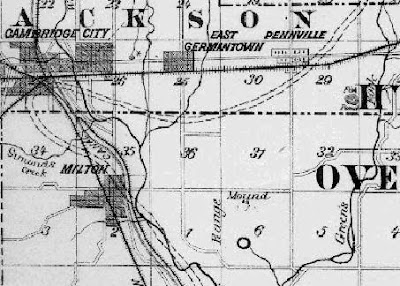
Atlas of DeKalb County, Indiana, 1880
      Two similar mounds, plow river were on the farm of John Taylor and one on the neighboring farm of John Boyer. In these were found only fragments of pottery and charcoal. There is a mound on the farm of Mrs. Hammond near these mentioned.

Note: If one travels five miles northeast of Waterloo you would be in Section 10 Franklin Township, this is where we found the possible stone mound. There is a Boyer property adjacent to the Taylor property, but there was no information available from residents about mounds existing on the property.

Annual Report of the Board of Regents of the Smithsonian Institute, 1874
      On the adjoining farm of Mr. Taylor about half mile distant, were two more mounds. We dug into one of them, finding again charcoal and fragments of pottery, but no human remains. None of these mounds are more than three foot high and generally have a base from twenty to thirty feet. All through this section many flints, carved implements, and ornaments of stone are found by the farmers. Some of them are perforated, and nearly all are of the banded siliceous slate, which seems to have been so highly prized by the Mound Builder.”

Annual Report of the Board of Regents of the Smithsonian Institution, 1874.
“Antiquities of Allen and DeKalb Counties Indiana” by R.S. Robertson.
      I enclose by today’s mail manuscript description of mound remains in Allen and DeKalb Counties, which I hope may be considered worthy of a place in your report. I think it important to describe locations of mounds as far as discovered, and when Northern Indiana is fully explored, it will prove rich in prehistoric remains.
     I have been careful to defer noting anything from reports, which are almost always much exaggerated until I can verify them by personal examination. For instance, some ten days since I rode twelve miles in a carriage and ten on horseback and return, to visit a fortification and mounds in the north part of Huntington County, only to find a very large beaver dam. As reported to, it was said to enclose from 150 to 200 acres. I found a beaver dam in zigzag lines, nearly 1000 feet in length, and a half a mild farther on two more, one about 300 and the other 600 feet long.
     During the summer I have investigated the prehistoric remains of Allen and DeKalb Counties as far as my opportunities would allow. All that I have discovered thus far have been in the vicinity of the St. Joseph River, which flows from the northeast to the head of the Maumee and one of its tributaries, Cedar Creek, which flows from the northwest into the St. Joseph . . .
      Near Waterloo, in DeKalb County, R.W. McBride, Esq., an enthusiastic archaeologist and collector, had excavated two mounds, finding in one the remains of a great number of human skeletons, apparently buried in a promiscuous heap, and the other, not a far distance, a single skeleton. The bones were too much decayed for preservation. One of the skulls, he says, appeared to have been crushed by a blow from a blunt instrument. He found no works of art, but in examining the rubbish afterward with him I found a butt-end of an arrowhead of flint and a small fragment of pottery. These two mounds are about fifty feet apart, are about thirty feet in diameter and about four feet in height, and are situated on the high ground bordering a marsh, which has once been a small lake. The remains were laid on the surface of the ground, covered with earth, and fires built, which baked the earth and calcined some of the bones. Quite a layer of charcoal and ashes was passed through in diggings, and above this layer earth had again been heaped.

R.W. McBride also submitted this article to The Indiana Quarterly Magazine of History, Volume II, 1906 about these mounds. Titled: Indiana Mounds in DeKalb County.
     Two of these mounds were on the bank of Cedar Creek, about one-half mild northwest of Waterloo on the farm of Daniel Godwin. Large trees were growing around them, and quite a large tree grew about in the center of one of them, - the smaller of the two. The large mound was about twelve feet in diameter, and about four and one-half or five feet in height. It contained the skeleton of one person, apparently buried in a sitting posture. The other contained the remains of a number of persons. The bodies had apparently been placed in a heap on the ground, and covered with earth. Fractures of some of the skulls indicated violent deaths. Above the earth covering the bodies was a layer of stone and over this more earth and a thick layer of charcoal mingled with charred fragments of human bones. At that time, after careful examination, I concluded that these mounds marked the site of a battle; that the victors of those left in possession of the field had made these mounds the burial place of their dead, and had burned the bodies of their dead enemies in the mounds above them. . .

Very respectfully,

Robert W. McBride
Indianapolis, January 10, 1906

The Smithsonian Annual Report, 1874, R.S. Robertson
      We next went to the farm of Henry Gonzer in Fairfield Township, there a mound once overlooked a small lake, which is gradually filling from the wash of the surrounding hills. The mound is now nearly obliterated by cultivation. We were informed by Mr. Gonzer that it was opened about twenty years ago, when the skeleton was found thigh bone of which was as long as his leg, and the skull as large as a half bushel measure. We dug a little below the surface, and found a few bones, among which was a broken thighbone of ordinary size . . .

Atlas of DeKalb County, 1880
       And one on the land owned by Henry Gomer in Fairfield Township, there were found bones and charcoal. 
       Like mounds (Taylor farm) exist on the farm of Christian Keller, in Wilmington Township, Alonzo Lockwood, in Jackson, Mr. Martin near Newville, and on the farm of Mr. Tyndal near Spencerville, in Concord Township. Four of these being opened proved to be burial mounds containing human remains and pottery. Near the crossing of the Baltimore and Ohio Railroad over the St. Joseph River, on the old Blair Farm, were found several of these earth tombs, from which arrowheads and stone hatchets were obtained. On the farm of Mr. Kepler, in Smithfield Township, are three mounds, in one of that was found a quantity of charred corn in a state of preservation. In Smithfield Township, on the farm of Mr. Refner, is a circular earthwork having a circumference of about two hundred yards. The embankment is in places two and half feet high, and is surrounded by a ditch. To the northeast and southwest are entrances and large trees standing on bank and ditch.


Circular Iroquois earthwork located south of Ashley, Indiana.  These circular works extended along the southern shores of the Great Lakes to New York.  This work marks their western extent.


History of the Maumee River Basin, 1905, Slocum
       Beginning in the northwestern part of the basin and following down the streams, we note first, a circular ridge of earth on the morraine in the northeastern and highest part of Smithfield Township, DeKalb County Indiana. The ridge is rather indefinite in part, with indications of possibly two original openings while in other places it is yet nearly three feet in height. Its diameter is about 200 feet.

History of DeKalb County, 1885
     The Mound: is an elevation of ground on the Ashman Farm. It is about ten rods from the “Little St. Joe” and on the south bank of a small creek that empties into the St. Joe at this point. It was opened in the fall of 1837 by Silas A. Bartlett, Daniel Strong Jr., John Platter and Frasier Bartlett. They found a large quantity of human bones about three feet from the surface. The elevation was then ten feet, but is now only about four. It is evident that this was a sepulcher of the mound builders, and the rude earthworks indicate that here was also at some time a fortification.”


This is the only ancient Iroquois burial mound that was found in Dekalb County, Indiana, located on the Little St. Joe River.  There was no evidence of any additional earthworks.

       Did you know that there are over 85 burial mounds and earthworks in Indiana? Discover Historic Indiana.  Ancient Indiana Tourism Sites Revealed for the First Time
     Discover the antiquities of the Ohio Valley with the most comprehensive Travel Guide to the burial mounds in Indiana, Ohio, West Virginia, Kentucky and Michigan.  222 burial mound and earthwork sites photographed and directions provided.

Mound Builders in Fort Wayne (Allen County) Indiana


 Mound Builders in Fort Wayne (Allen County) Indiana


Various Birdstones and Tube Pipe Found in Allen County, Indiana.


Map showing location of Indian Burial Mounds and earthworks near Fort Wayne in Allen County, Indiana

The History of Allen County Indiana, 1880
“Prehistoric Remains” by R. S. Robertson:
     What became of them is another question, which will probably forever remain unanswered. That they disappeared at once is wholly improbable, as is also the theory that they were totally destroyed. The most probably theory is that as they met the first eruption of the savage red man from the northwest, and all Indiana tradition points to this quarter for the place where the Indians came, they were gradually driven in their outlying settlements, and finally overwhelmed by the constantly flowing tide of ruthless savages, more skilled than they in warfare, and envious of their rich hunting grounds.
     The remnants of the Mound-Builders would be pressed by southward, whence they came and those of the savages who followed them to the south and overcame them would retain more of their customs than those tribes of the north who amalgamated with them in lesser degree, or not at all .
     Northern Indiana has many proofs of the presence of this race recorded almost indelibly upon its soil, and they have left some of their monuments in Allen County, but not as many, nor so extensive, as ones found in Ohio or to the southern part of Indiana.
       While some of them were pushing upward, and making great settlements along the tributaries of the Ohio, others had passed further up the Mississippi, discovered The great Lakes, and entered into quite extensive copper mining operations on the shores of Lake Superior. Colonies had occupied Michigan, and as far south in Indiana as the Kankakee, and it from them, we think, that Allen County received the marks of their occupation. All along the valley of Cedar Creek, in DeKalb County, their mounds and earthworks appear in considerable number, but decrease in number as we proceed southward onto Allen County, and we totally wanting in the southern portion of the county.
       On Cedar Creek, near Stoners, on the Fort Wayne J & S Railroad, is a group of four mounds. Two of them are in a line north and south and are about forty feet apart. About fifteen rods east of these are two others about the same distance apart and on a line nearly east and west. When visited by the writer a few years since, three of them had been partially excavated years before and were said to have contained a large number of human bones, arrow-heads and some copper ornaments. The remaining mound was excavated at the time but disclosed only lumps of charcoal and a layer of hard-baked earth near its base.
     These mounds are situated on the high ground between the Cedar and Willow Creeks, and the Auburn Road passed between them.
      Four miles south of these on the Coldwater Road, on the farm of Henry Wolford (now owned by Mr. Bowser) is a large oblong mound which was only partially explored, but in which a perforated piece of ribboned slate was found, with much charcoal and a stratum of baked earth.
      At Cedarville, on the St. Joseph, near the mouth of Cedar Creek, are three mounds about a hundred feet apart, situated on a line running northwest nearly parallel with the general direction of the river at this point. None of them have been fully explored, but one has been nearly removed to use its earth for mending the road, and charcoal was found in considerable quantities, as is usual in mounds of this class.
      Descending the St. Joseph on the east, to the farm of Peter Notestine, one of the oldest settlers, we find a circular “fort” or earthwork, situated in the bend of the river... it has been plowed over for nearly thirty years and has lost much of its outlines. Many relics have been found here, and when newly plowed, numerous fragments of pottery, flints, and stone implements are yet found in and around its site. A large pipe of pottery was found here some years since. The bowel and stem are molded in one piece and the end of the stem has been flattened by the fingers while plastic to form a mouthpiece.


Henge or open air sun temple on the St. Joseph River near Fort Wayne, Indiana. The gateways to henges are generally aligned to solar events.  This gateway is aligned to the May 1st sunrise.  The pipe described in the previous history is diagnostic of the Point Peninsula Iroquois that would date this henge from 200 B.C.- 200 A.D.; a date that contemporaneous with the many henges in central Indiana and the Ohio Valley that were constructed by the Adena. The Iroquois from this time period had assimilated many of the Adena burial mound and earthwork traits.

.Still further down the river, on the west side, opposite Antraps Mill, is a semi-circular fort with its ends on the riverbank.
It is about 600 feet in arc. The earthwork is yet nearly two feet high, with a well-defined ditch on the outside. Very large trees, which have grown on the embankment, have fallen and gone to decay. We found in the earth, which had been upturned by a fallen tree, a fragment from the neck of a vessel of pottery with square indentations on the surface.


A series of these horseshoe shaped works extended down the Maumee River to Toledo. They along with the circular works were all 200 feet in diameter.

The Earthen walls of this prehistoric Iroquois work can still be seen north of Fort Wayne, Indiana.
No efforts have been made to preserve the earthwork and it is not listed as an historic site.  It was subjected to excavations by IPFW archaeologists, the last few years, but what damage was done to the work has not been investigated.  The Allen County Historical Society [ It's  a "Center" now] was informed of the earthwork, but claimed they "had no interest" ????

      Still further down the river, on the east side, at the mouth of Breckenridge Creek, is a single mound, which has not been opened except a slight excavation in its side, which developed the customary lumps of charcoal. This point is about four miles north of Fort Wayne, and is the most southerly point in the county at which mounds and earthworks are known to exist.


Iroquois burial mound can still be seen on Breckenridge Creek, the dam has raised water levels and it is now partially submerged part of the year.


History of the Maumee River Basin, 1905
     Nine mounds have been determined on the high banks of the Maumee River. Two of these mounds are in Indiana near the Ohio line.


Iroquois Burial mound in eastern Allen County on the Maumee River, before being desecrated by IPFW archaeologist who removed the skeletons from the mound so that they could be boxed up at the University. Despite the overwhelming evidence that the mounds in Allen county were Iroquois, the Universities refuse to acknowledge the fact because it invokes the Native American Graves Protection Act that deems it a crime to dig in to a  grave of a "known" tribe.

Another burial mound located on the Maumee River in eastern Allen County. An excavation by Indiana University has left a hole in the top giving it a "volcano" appearance.

Near the last mound is this rare venerated Spirit Tree that was part of the sacred landscape that also included the rapids of the Maumee.  The tree was struck by lightning a few years ago and has been destroyed.  


Mound Builder Ruins in Paulding County, Ohio


Mound Builder Ruins in Paulding County, Ohio 


History of the Maumee River

. . . Four burial mounds also on the South Bank at Antwerp Ohio, the first of which is one mile west of this village, the second in the park within the corporation, the third one-half mile, the fourth one mile eastward.

A fifth mound was in the Ohio Archaeological Atlas and was located in the northwest quarter of Section 32, Auglaize Township on the Auglaize River.

No histories describe these mounds or the contents found.

   I thought the mound in the park would still be there, but it was not?


Mound Builders in Defiance County, Ohio

Mound Builders in Defiance County, Ohio


Historical Map of the City of Defiance with the burial mound locations listed.  There were 5 total in the city, but nothing was located.

History of the Maumee River Basin, 1905
      A mound was found on the high south bank of the Maumee River, a few rods west of the middle north and south line of Section 27 of Defiance Township, (nearly a half mile above the present waterworks pumping station) by Joshua Hilton, who purchased the farm embracing this land in January 1822. This mound was about four feet above the surrounding land, about thirty feet in diameter and was covered with oak trees 18 to 20 inches in diameter. Mr. Hilton and his son, Brice, who gave the writer this information, opened this mound in the year 1824. A small quantity of bony fragments were found which readily crumbled between the fingers on being handled. Human teeth were found, some of which were of large size. Some dark stone gorgets were also found, about four by two inches in size pierced with slanting holes of “goose quill” size. This mound was excavated and used as a cellar by the family, the first house, built of logs, being at a convenient distance from it. The site of this mound was undermined by river many years ago.
Old photo shows the burial mound that is eroding down the bank near the pumping station in Section 3 at the mouth of Garman Run.  Today, nothing is left of the burial mound.

History of the Maumee River Basin, 1905
       Along the Auglaize River, five mounds have been determined, two in the western part of Putnam County, near Dupont, and three in Defiance Township. One situated on the high east bank near the south line of Section 3, about four miles southwest of the Defiance Court House is now nearly obliterated by infringement of the public road and undermining by the river. (See picture) This mound was opened by curious neighbors previous to 1870. Decaying bones of eight or ten persons, who had evidently been buried in sitting posture, were found with charcoal.
  I highlighted the fact that the burial mound had bodies placed in a sitting position that is diagnostic of the early Iroquois who were the builders of the mounds along the southern tier of the Great lakes.  Generally there is also either cremations or evidence of charcoal in the grave.

      A smaller mount, about two feet high and fourteen feet in diameter, was situated on the high west bank of the Auglaize, near the middle north and south line of Section 34, two and one-fourth miles southwest of Defiance Court House. It was explored in the summer of 1878. About six inches below the surface of the central part of a circular group of stones varying from two to five inches in diameter were found that had been taken from the river channel near by. They rested upon a layer of clay two inches thick, like the surrounding land in quality, which had been subjected to great heat while wet and was consequently, very hard and brick-like. Beneath this layer of clay was a layer of ashes two inches thick, and eight or ten sticks of thoroughly charred wood about two feet long and two or more inches thick in their largest parts. With the ashes were, also, bits of charred flesh and small bones, perhaps of some animal, but the kind could not be determined, and small fragments of crude pottery which easily crumbled. Upon removing the ashes and about one foot of hardened earth, human bones were found in an advanced stage of decomposition, consisting of parts of the calvarium and long bones of one person, head lying a little east of north. With these bones was found only one gorget four inches long, one and three-eighth inches wide and one-half inch thick, tapering on the sides toward the ends, and with two holes one and a half inches apart and equal distant from the ends.  These holes are of one-fourth inch diameter on one side and taper gradually and smoothly to one-eighth inch on the opposite side. The gorget is of Ohio shale such as is seen in the bed of the Auglaize River near by. About forty rods north, also on the high bank overlooking the river, was another mound of like size and contents, excepting the gorget.
     This mound shows evidence that the burial mound was the site of a charnel house (where the dead were paced prior to internment in the burial mound) that was burned and the burial mound erected over it.  Again, this is typical of the burial mounds in northern Ohio and Indiana.

Mound Builders In Fulton County, Ohio

Mound Builders In Fulton County, Ohio


Story of the Maumee Valley, 1929
      Fulton County contained more prehistoric works than any of the Northwestern Ohio counties. Quoting from authority, although it has no large streams, the topography is such that the county is well drained, the mean elevation is greater than that of the adjoining counties. On the broad, level tablelands of the central portion of the county, prehistoric evidence was abundant, particularly in present Pike and Chesterfield Townships. On the headwaters of Bad Creek in Pike Township, there were twelve mounds that practically formed a group. There were six recorded enclosures in Fulton, and forty-five mounds in the total earthworks numbering sixty-four, number of total mounds equal forty-five, earthworks six.

A Standard History of Fulton County, Ohio, 1920
      Of the works examined in this county, those most worth of mention are situated on the farm of the last Hon. D.W. H. Howard, in Section 9, Pike Township. These mounds were explored during the summer of 1892, through the efforts and under the direction of Hon, W. H. Handy, to whose excellent article upon the same we are indebted for the information here given concerning them. And much credit is also due to Mr. Howard, upon whose farm and in which orchard most of them are situated. During all of his left he jealously guarded these mounds against vandalism, permitting no one to in any manner interfere with them, further than to cultivate the round. The mounds are located on the southeast quarter of the northwest quarter of section nine, in Pike Township, and are built on a high ridge, containing five or six acres of land, and follow the highest outer elevation of the bluff with three exceptions.
       These mounds are in a group, twelve in number, of which eleven are located and clearly identified and the site of the twelfth is plainly indicated. One of them is built on the northern edge of the bluff, and a distinct, well-defined terrace appears on the north side of the mound. Another one is located in the public road, near by, and has been almost entirely bolstered. The others, while their outlines are somewhat indistinct, can be easily seen. The soil is a top-dressing of light sand, mixed, however, at the depth of six or seven inches with gravel. Long years after these mounts were built they were exposed to the winds and rain, and consequently, they have lost much more by erosion than they have gained by decaying vegetation or otherwise. Beside, they were cultivated more or less for many years. The first excavation was made of a mound about thirty-five feet in diameter, and about ten feet from the center small pieces of charcoal were found. The soil was composed of six inches of mould, eighteen inches of white sand, with yellow sand mixed with some gravel at the surface. At about the center, two altars were uncovered, one a circle and the other a parallelogram, the circle lying directly south of the other, and being four feet in diameter, while the parallelogram was about four by six feet. On the circular altar were found some remnants of human bones that had been partially burned, among them being a jawbone containing four teeth. On the other were found the bones of many different animals, these also being partially burned. Very near the original surface, but with the baked earth covering him, immediately under the circular alter was found the skull and a portion of the skeleton of a man, lying on his face with head to the west. The part of the skull above the nasal bones was well preserved, and compared with the skull of an Indiana, found intrusively buried in the neighboring mound, was a distinctly different type of man.
       It was noticeable that the burned sand of the alters was as dry as the dust that blows in the street, while the original soil under the alters, and which had not been burned, was found to be moist. The ground of which the altars were composed has never been disturbed since the fires went out. This was demonstrated to a certainty, as no digging could ever have been done without disturbing the strata, and it had never been disturbed. The baked sand, the red burned ground, and the charcoal were in as perfect layers as if placed there by the hands of a mason. The mound mentioned as being located in the public road is, as stated above, entirely obliterated, but in an early day Col. Howard found in its center a circle of stones about four feet in diameter, containing within the circle about a bushel of charcoal and ashes. The stones were what are known as “nigger-heads.”
       Nearly all of these mounds were opened and examined by Judge Handy, and the report of two of     them we will give in the Judge’s own language. Of the one he calls Mound No. 7 he writes: “Sand soil, light yellow sand: about eighteen inches from the surface found longest thigh bones yet discovered. No traces of fire--no disturbance of soil theretofore--bones crumbled on exposure--highest of the mounds--found near center skeleton with his head to the north, lying on his back and limbs extended--near him found skeleton No. 2. with his head to the east and lying on his face. Both being large men--bones crumbled and could not be preserved--teeth perfect. We entered Mound No. 6 from the south. Soon after we commenced work here we discovered that the soil of this part of the mound had been disturbed. After digging about ten feet to the north and about fourteen inches below the surface, we found an iron tomahawk, English made. Close by we found the skull and part of the skeleton of an Indiana lying on his side with his feet to the south. His arm was extended to the tomahawk. Going west of this, we soon came to ground that had never been disturbed. Here we found an altar, eight feet and seven inches in diameter, and round. We cut the dirt away from this and cleared the mould from the top, and save a portion that had been cut off by the digger early in the morning, we had the altar as it stood when the last fires went out many centuries ago. This altar had upon it, partially burned, animal and human bones. We found many pieces of human skulls, both of grown people and children: parts of the bones of the arm and the lower limbs; the hip bone, ball and socket of a child: most of them charred; some of them having a bluish tint; the charred bones of many animals all in the red burned sand on the altar. The altar was nearly level on the top. It was built up, commencing at the bottom, as follows: Yellow sand about eighteen inches, but fire had burned the lift out of this; soil burned red, three inches; charcoal, two and one-half or three inches; red burned soil, four inches; sand and mould, six inches.
       “When we uncovered the altar in Mound No. 6 and exposed it to view almost in its entirety, we had before us the sacrificial altar of a great, lost, powerful people. We saw it as they saw it, ten or more centuries ago, when they covered up its fires forever. It told us much-it told us nothing. They burned human beings; they burned animals. Was it cremation? Hardly, for it was complete. Was it sacrificial? Probably. But to what deity or deities? Alas! We will never know. Who did these people succeed? What caused the destruction of the Mound Builders? Who followed them? A thousand years from now who will have succeeded us?”
       In every instance it was definitely ascertained that many persons were buried in the same mound. Mr. Howard was authority for the statement that the Indian had no knowledge, traditionary or otherwise, concerning these earthworks, and if the Mound Builders were the ancestors of the Red Med of recent date, such fact was unknown and unsuspected by the latter. Mr. Howard associated from boyhood with them and accompanied them to their reservation beyond the Mississippi; was always their friend; able to converse with them in their own language, to get into their inner lives, as it were; to appreciate and credit them with their virtues and condemn their faults, he easily became their confidant and possessed of their traditions. He stated at the time of the excavations that he heard old Chief Winnameg say “that the oldest man did not know who made the mounds, and the nobody knew, but he thought that a great battle had been fought there and the dead buried in the mounds.” It is a well-known fact that the Indians never prepared burial places for their dead like the mounds referred to; neither did they erect alters, where animals and human beings were immolated to secure the favor of the Great Spirit and afterward cover such altars with a mound of earth. These, and many other important considerations lead the majority of students of antiquity to the opinion that the Mound Builders were a distinct race of people, and that they inhabited a large portion of America long before the Red Men took possession.


Get the directions to all of Ohio's mounds and earthworks.  Over 100 sites revealed for the first time.

Mound Builders in Wood County, Ohio


Mound Builders in Wood County, Ohio


The Story of the Maumee, 1929
    Wood County had a few scattering prehistoric sites mostly along the Maumee. Mill's archaeological atlas marks an enclosure in the extreme northern border of the county on the riverbank below the Ford Plate Glass works, Rossford. Most reliably generally, it is possible that this was not an enclosure as Mill's states, but a more than ordinary burial mound. Civilization long ago destroyed its identity.

The Maumee River Basin, 1905
    Three semi-circular ridges of earth were found along the lower Maumee River. The first was observed between the years 1837 to 1946 and the book (Ancient Monuments of the Mississippi Valley, by E. George Squir and Dr. E.H. Davis, Washington 1848) from which the accompanying engraving is made, was published in 1848 as the first volume of the Smithsonian Contributions to knowledge. The description given at that time read that:
This is one of the earthworks that were all the same size and shape along the Maumee River. One of these earthworks can still be seen up the river at Fort Wayne, Indiana. For over 100 burial mound and earthwork sites in Ohio with photos of each and direction, click the link.  Over 222 burial mounds and earthworks in Indiana, Ohio, West Virginia, Kentucky and Michigan.


This work is situated on the right bank of the Maumee River, two miles above Toledo, in Wood County, Ohio. The water of the river here is deep and still, and at the lake level; the bluff is about thirty-five feet high. Since the work was built, the current has undermined a portion, and parts of the embankment are to be seen on slips, a, a. The country for miles in all directions is flat and wet, and is heavily timbered, as is the space in and around this enclosure. The walls measuring from the bottoms of the ditches are from three to four feet high. They are not of uniform dimensions throughout their extent; and as there is no ditch elsewhere, it is presumable that the work was abandoned before it was finished. Nothing can be plainer that most of the remains in northern Ohio are military works. There have not yet been found any remnants of the timber in the walls, yet it is very safe to presume that palisades ewer planted on them, and that wood posts and gates ever erected at the passages left in the embankments and ditches. All the positions are contiguous to water; and there is no higher land in their vicinity from which they might in any degree be commanded. Of the work’s bordering the on the shore of Lake Erie. Through the State of Oho, there are none but may have been intended for defense, although in some of them the design is not perfectly manifest. They form a line from Connecticut to Toledo, at a distance from three to five miles from the lake, and all stand upon or near the principal rivers . . . The most natural inference with respect to the northern Cordon of works is, that they formed a well-occupied line, constructed either to protect the advance of a nation landing from the lake and moving southward for conquest; or a line of resistance for people inhabiting these shores and pressed upon by their southern neighbors. The scarcity of mounds, the absence of pyramids of earth, which are so common the Ohio River, the want of rectangular or any other regular works at the north-- all these differences tend to the conclusion that the northern part of Ohio was inhabited by a distinct people.

Tuesday, September 27, 2011

An Archaeological Survey of Adena Indian Burial Mounds and Earthworks in Wayne County, Indiana

An Archaeological Survey of Indian Burial Mounds and Earthworks in Wayne County, Indiana


A map showing the locations of burial mounds and earthworks in Wayne County, Indiana

Eighth Annual Report of the Geological Survey of Indiana, 1876
      The high table-lands of this county, and its deep canon-like river valleys, afforded the Mound Builders favorable sites for their settlements, and we constantly find the remains of a number of large and interesting earthworks and a great many mounds scattered along the bluffs of the streams. Prof. J.C. MacPherson, county superintendent of schools of Wayne County, has kindly furnished me with a sketch of these ancient works, and as he has given considerable attention to the study of archaeology, his report is a very valuable acquisition to our knowledge on this subject, and I take pleasure in presenting it to the public.

Observations on the Prehistoric Earthworks of Wayne County, Indiana”
     The surface of Wayne County presents many evidences of occupancy by the Mound Builders. Mounds are found in all parts of the county-situated on the uplands and along the courses of the streams. The plowshare has leveled many, and some have been removed in opening roads to the material used in making brick. Twenty-five mounds have been located on a map of the county prepared in connection with the geological report.

The works in the county seem to be a continuation southward from the works along White River in Randolph County, and follow the branches of the White Water. Perhaps, when all the works located in this part of the Ohio Valley are mapped, some systematic arrangement may be discovered.

Three miles north from Fountain City (formerly called Newport), on a rise overlooking the wooded valley of Noland’s fork, is a mound seventy-five feet in diameter, (section 19, township 18, range 15 east).


A slight undulation in this field still marks the site of this burial mound.  

Another is on the farm of Daniel Hough, adjoining Fountain City. A third is said to have been removed in making the principal street of that town.

One mile northeast from Fountain City, on level ground, between Noland’s fork and a small tributary-Buck run-is an embankment enclosing eleven acres. The figure (Plate C) of this earthwork is a square with curved corners. The length on the inside of the embankment is 780 feet. The embankment has been plowed over for years, yet can be plainly traced. A gateway is discernible on the west side, and hollows are found in the vicinity, which some suppose were made by the builders when collecting material for the embankment. Since the accompanying map was made, a more careful survey has discovered the fact that the direction of the embankment is not due north and south, but at an angle, with the west side nearly parallel with the road.


Making the correction stated above about the position of the earthwork, if it was parallel to the road the gateway would be aligned to the summer solstice sunset and would again align to the west on the winter solstice sunrise.   


Undulations in this field are the only remnants of the once massive 50 feet wide earthen wall that enclosed this sacred temple. I have a LIDAR image of this fort where you can see the wall perfectly. https://adenahopewellmoundbuildersohiovalley.blogspot.com/2019/03/wayne-county-indiana-adena-square.html


A large mound stood two miles north from Chester (Section 4, Township 14, and Range 1 west). The greater part was removed in making the Arba road. A copper ring was found therein, and is now in the collection at Earlham College. (Judge N.R. Overman informs me that four copper bracelets were found. He has one in his cabinet. He also has three flint implements taken from this mound.)

Several mounds are situated in the neighborhood of Middleboro. Some have been opened, but no contents worthy of notice have been obtained.

One mile north from Richmond, on the Hoover farm, and in the vicinity, several small mounds were located. In one, when removed, was found a copper ornament.


The map shows two burial mounds and a square enclosure within the city limits of Richmond


One of the burial mounds near the square enclosure is still visible in some dense thickets. The mound is unique in that a graded way leads to second terrace below.

A mound near Earlham College was opened by President Moore and the usual contents of mounds found-pieces of pottery, ashes, and other evidences of fire.

On the J.C. Ratliff farm a mound was opened, and some small articles, which were at first supposed to be beads, but are now thought to be parched corn, found therein. L.B. Case, of Richmond, has some grains of corn, which were found in a jar some distance below the surface of the ground, in the vicinity of that place.

A large mound south from the town of Centreville was deemed of sufficient note to be marked upon an early map of the State, but has since been destroyed.

In the southwestern part of Boston Township is a mound hidden away in a “hollow”; and one formerly stood south from Richmond near the Boston pike.


A small burial mound located in a holler next to a small creek.  Small burial mounds like this that are tucked away far from the road are in the greatest danger of being destroyed by University archaeologists. 

Traces of a mound are to be seen on the farm of James W. Martindale, adjoining Washington. This mound was opened in early times, and charcoal found near the original surface of the ground. A great quantity of arrowheads has been found around a spring (long since dry) near this mound.

A circular embankment was found near Green’s fork, east from Jacksonburg, twenty-five feet in diameter. It was long since plowed down.

Two mounds are to be seen a short distance northwest from Jacksonburg.

Overlooking Martindale’s creek in Jefferson Township (section 18, township 17 north, range 13 east,) is a mound. Also two in the bottom land along West River, at Hagerstown.

Two miles southeast from Milton (section 6, township 15, range 13 east,) is a beautiful mound, fifteen feet in diameter. Forest trees are still standing upon it; also a stump measuring two feet across.


Headwaters to creeks were Sacred Grounds to the early mound builders.


The burial mound is still visible in this field, but it is now under cultivation.  It appears that this mound is of natural origin, but was used for burials.  

Near the county line, about one-mile north of Waterloo, Fayette County, is a mound upon high ground, and about a mile to the southeast, in Fayette County, is a curiously shaped.


This mound is visible across the road from the holler.  According to the landowner it was much more conical years ago before being plowed.


The most notable mounds (Plates A and B) in Wayne County are located on the left bank of the west branch of the White Water River, one and a quarter miles north of Cambridge City. They consist of a series of circular embankments, continued over half a mile of ground.


Earthwork cox near Cambridge City, Indiana

The south circle (Plate A) is in the best state of preservation. The embankment was made of the earth taken from the trench, which is on the inside of the embankment. Within, the ground has been made to slope gently from the center to the bottom of the trench, except to the east, where there was left a roadway leading from the center through a gateway in the embankment to the level ground beyond. The embankment is four feet above the surface of the field, and seven feet above the bottom of the trench, and wide enough on the top to allow two carriages to pass each other. The gateway is one rod wide. This circle is made of gravelly soil, while the north circle is composed of a loam, and has yielded more to the destroying influence of plowing.  It is not as symmetrical as the other, being more oval in outline.


Two large henges of the Cambridge City earthwork complex.  The north henge is aligned to the summer solstice sunrise, and would align again on the winter solstice sunset.


Henge complexes at Mounds State Park in Anderson, New Castle Indiana, and Athens, Ohio all contained 8 works in the group. From the previous map, the Indiana Geological Survey placed 7 north along the river and the two main henges.  In this aerial photo the 8th earthwork is revealed next to the southern henges northwest side.  A similar, smaller circle also occurs at Mounds State Park in Anderson, Indiana. I have a LIDAR image of this site that reveals a new revelation about the north work that was not a circle but a Panuriform.  To see the photo https://adenahopewellmoundbuildersohiovalley.blogspot.com/2019/04/wayne-county-indiana-panduriform-henge.html


Despite being plowed for years the central platform and exterior ditches are still visible of the Southern Henge. The gateway also still visible and marking the yearly equinoxes as it has done for the last 2000 years.

The class of works to which these belong is described in “Ancient Monuments of the Mississippi Valley,” page 47, and are denominated “Sacred Enclosures.”

These two circles on Plate A, are about fifteen rods apart, and about the same distance from the bluff of the stream. In the bluff, equally distant from both the circles, is a passageway cut from the top of the bluff to low ground bordering the water, some twelve feet below. This cut is evidently not a water-wash, for along the sides can be seen the earth which was removed in making it thrown up as dirt is thrown up along the sides of a ditch.


This "cut" is still visible between the two henges that leads on a gradual descent to a small creek that runs to the west of the earthworks.  It is evidence of an important concept at most earthworks sites that will have elements of both the Sky Father (sun) and the Earth Mother (creek)

The bluff here spoken of is the edge of the first terrace. The rounded margin of the second terrace can be seen a quarter of a mile to the east.

Several hundred feet north from the second of the above-described circles is a group of five small circles (Plate B). With one exception these are about sixty feet in diameter, and are now from one to two feet high. The circle numbered 3, on Plate B, is at the point of a tongue of higher ground, and affords an outlook over the other works.  The embankment of the largest work in this group (numbered 7) can not be traced on the south, that part being in a field which has long been cultivated. Trees of large size were, until recently, standing upon the embankments of these works.

Burial places and remains have been found in various localities within the county. A number of years ago, in removing the gravel from a bank in the northwest part of Jefferson Township, nine feet below the surface, eight skeletons were discovered. They had been buried in an upright position. These bones were gathered together by the workmen and reburied in a common grave. In constructing the Valley Railroad from Hagerstown to Cambridge City, human remains were exhumed; also some at the latter place.

O. Beeson communicated to the local papers some twelve years ago an account of the discovery of a burial place in the extreme southwest corner of the county. Many skeletons were found in a gravel bank, some having been placed in a sitting posture and some with the head downward.

Recently some twenty or more skeletons were unearthed in a gravel pit on George Jordan’s farm, about two miles northwest from Economy. These bodies seem to have been buried in graves a few feet apart, and six feet below the surface. Some of them were in a sitting position, while others were in various positions.

The discovery of a human skeleton in a mound on the bank of White Water, near Richmond, many years ago, was the occasion for the following lines from the pen of the late John Finley; author of the “Hoosier’s Nest,” and other poems, and once Mayor of Richmond.

“Year after year its course has sped,
Age after age has passed away,
And generations born and dead,
Have mingled with their kindred clay,
Since this rude pile, to memory dear,
Was watered by affection’s tear.

* * * * * * * * * *

“No legend tells thy hidden tale,
Thou relic of a race unknown!
Oblivion’s deepest, darkest veil
Around thy history is thrown;
Fate, with arbitrary hand,
Inscribed thy story on the sand.”

Stone and flint implements were formerly found in great numbers in this region. Wayne County, like the rest of our State, has suffered in being robbed by collectors and traffickers, who have carried away many specimens to grace the museums of other states. But recently more interest has been manifested in the subject of archaeology, and the collection at Earlham College, and several private collections, are beginning to assume interesting proportions.

Setzler’s Survey”, Indiana Historical Society
The Indiana Historical Society is in leauge with the university archaeologists and the DNR to destroy every mound in Indiana. Despite a historical legacy than spans thousands of years the Indiana Historical Society has not saved, preserved or even noted any of these antiquities as historic sites. They have given millions of dollars to universities to desecrate burial mounds across the State.
The following list is a good example of the mindless destruction done to Indiana's antiquities by the Indiana Historical Society.

These are mounds in his report in addition to mounds reported by McPherson.

1.) Schroeder Mound. On the east bank of the Green Fork. Diameter of mound twelve feet, six inches. Located in the southeast one quarter of Section 21, Green Township.


Very little remains of the Schroeder mound after Setzler and the Indiana Historical Society were done with it.

*If mound found in frac.-Section 19 of New Garden Township, mound was originally forty feet in diameter and three feet high.

2.) Teetor Mound. Located one mile east of Hagerstown on Highway 38. Originally the mound was 43 feet in diameter and eight feet high.  Southeast quarter of Section 23, Jefferson Township.

3.) Wolford Mound. Measured 45” in diameter and five and half feet high. One-quarter mild northeast of the circular earthwork. Mound’s location was the northeast one quarter of Section 15, Jefferson Township.

4.) This mound was used by surveyors as a base for survey measurements. It was described as being 45 feet in diameter and nine feet high. Located in the northwest one quarter of Section 5, Jackson Township.

5.) Secrist Mound. Was located in a woods, one half mile southeast of Jacksonburgh. Mound was originally 42 feet in diameter and eight feet high. Located in the southwest one-quarter of Section 8, Harrison Township.

6.) Davis Mound. Near the edge of the east bank of the Green Fork stood a mound 43 feet in diameter and 5 feet high. Located in the northeast one quarter of Section 16, Harrison Township.

7.) No physical descriptions exist of two mounds located in the northeast one quarter of Section 6 and the northwest one quarter of Section 5, Harrison Township.

8.) In the northeast one quarter of Section 6 and the northwest one quarter of Section5, Harrison Township.

9.) Hodgins Mound. Original dimensions were thirty-nine feet north and south, forty-eight feet east and west and was three to four feet in height. Located in the southeast one quarter of Section 21, Wayne Township.


Burial mound is still visible on a table of high ground that descends into an aquifer. The mound is located within the city limits of Richmond.

10.) Richmond City Waterworks. Mound originally was thirty-five feet in diameter and nearly six feet high. Located in the northeast one quarter of Section 34, Wayne Township.


After an hour of clearing brush from the earthen heap, we were able to photograph the Waterworks mound.  It would be visible from the road if it were cleared.

11.) Mound once stood roughly 11,000 feet from the west bank of the East Fork of the Whitewater River in the northwest one quarter of Section 8, Wayne Township.

12.) One mile south of the City of Milton was a mound forty-nine feet in diameter and five feet high in the northwest one quarter of Section 11, Washington Township.

13.) A small mound was located in the northwest one quarter of Section 12, Washington Township.

14.) Doddridge Mound. Located on a sharp bend of Noland’s fork. Originally the mound was thirty-eight feet in diameter and three feet high in the southwest one quarter of Section 16, Washington Township.

15.) Robbins Mound. Mound used to be visible from the road that divides Section 17. Its size was forty-five feet east, west, and 35 feet north-south with a height of four feet. Location was the northwest one quarter of Section 17, Abington Township