google-site-verification: google1c6a56b8b78b1d8d.html
Adena Hopewell Mound Builders in the Ohio Valley: octagon
Travel to Ruins of Ancient America's Mound Builders. A complete list of Ohio Indian mounds, Indiana Indian mounds, Kentucky Indian Mounds, Wisconsin Indian mounds, Michigan Indian mounds. Adena Hopewell mound builders, giant human skeletons, Nephilim
Winter Photographic Gallery of the Newark, Ohio Earthworks Newark, Ohio earthworks in the winter. Pics from "The Nephilim Chronicles: A Travel Guide to the Ancient Ruins in the Ohio Valley."
The best time to visit the Newark earthworks is the winter months when you can freely walk the grounds.
Photo is taken from the gateway of the henge. In the summer months the ditch is overgrown and not visible.
This photo is looking in the opposite direction from the gateway of the henge that is aligned to the May 1st sunrise. On October 31st the sun will align with the gateway when the sun sets.
From the gateway the bird effigy is visible in the background. The bird represented 'transition' this could have been for the people buried within the effigy or the transition from spring to summer and fall to winter.
This earthwork or sacred via goes from the henge to the square earthwork. See map above.
One of the 8 walls of the Octagon with one of the mounds guarding the gateway to the left.
From the walls of the Octagon, a smaller circle with a serpentine gateway is still well preserved. The circle was at the opening of the Hopewell Road that ran from this spot to Chillicothe, Ohio, 60 miles distant.
Two parallel earthworks connect the Octagon with the circular earthwork.
Early Description of the Newark, Ohio Ancient Earthworks
The immediate vicinity of Newark seems to have been a sort of headquarters, or great central city. Newark, indeed, is built upon the ruins of the works of this mysterious people, many mounds having been leveled to make way for streets and buildings, and the city has extended into the Great works, of which a cut is here given. This drawing is taken from a survey by David Wyrick, in 1860, and gives a faithful outline of the Old Fort, and the connecting works within a radius of one mile. The outlying works are nearly obliterated, with the exception of some of the parallel lines and the Octagon fort and its connecting circle. The larger circle in the drawing marked "thirty acres," represents the most prominent and best preserved of all this series of works and is now owned and used by the Licking County Agricultural society; its preservation being thus assured. The portions of the cut represented by a square, and parts of the lines of an oblong, are nearly obliterated by the growth of the city of Newark in that direction. The octagon and circle marked respectively "fifty acres" and "thirty acres," have been partially subjected to the leveling processes. The whole plain between the South and Raccoon forks of Licking river, and covering an area of several square miles, bears traces of occupation by the "lost race." It is evident from the remains here found, that this section was densely populated, and the character of the works, too, bear out the assumption that this people passed through the different stages of existence that fall to the changing experience of nations at the present day. The following description of the Old Fort is probably the most accurate as to measurements and other particulars yet given, being the result of actual surveys made by Colonel Charles Whittle sey, of Cleveland, and Isaac Smucker, esq., of Newark : "The Old Fort is situated a mile and a half in a southwesterly direction from the court house in Newark, and belongs to the class of Mound Builders' works known as inclosures. It is not a true circle, the respective diameters being eleven hundred and fifty, and twelve hundred and fifty feet. Its banks, nearly a mile in length, were formed by throwing up the earth from the inside, which left a ditch of sloping sides, ten feet (in many places more) in depth, and ranges, in perpendicular height, measuring front bottom of ditch to top of bank, from twenty to thirty feet. This inclosure, which embraces within it about twenty-seven acres of land, was constructed on level ground, and the ditch above described was often seen, during the earlier decades of the present century, partially, and sometimes wholly, filled with water all around the circle. From some cause it has not held water of later years to any great extent. Viewed from the outside, the embankment does not rise more than ten to fifteen feet above the surface of the surrounding ground, but observed from its top, the eye taking in the depth of the ditch, it seems, of course, much higher, so as to correspond in height, at least, to the figures above given. "The Old Fort has an entrance or gateway, which is flanked by a high bank or parapet on either side of it, running outward forty yards. The gateway and parallel walls or parapets are on the eastern side, of the circle, and the ditch which follows it also extends to the termination of the parallel banks that cover the entrance. Mere the banks are highest; the parallel walls, as well as those which form the circle immediately adjoining them at the gateway, reaching, for a short distance, a perpendicular height of at least thirty feet, measuring from the bottom of the ditch, or twenty feet, measuring on the outside. The gateway or entrance measures seventy-five feet between the ditches or moats, and between the parapets or banks of earth that flank the entrance, one hundred and thirty feet around the circle, as well as upon the parallel walls at the entrance. They are equal in size to those that are yet found on the outside of the inclosure and \\ within it and of the same varieties. Some of them measure ten feet in circumference and are still thrifty, giving no indications of decay. One of the largest trees that stood on this embankment was cut down in 1815, and its concentric circles showed that it had attained to the venerable age of over one hundred and fifty years. In the middle of the Old Fort is an elevation, evidently artificial, which never fails to attract the attention of the observing, and is generally designated as Eagle mound. It is full six feet high, and is in the form and shape of an eagle in flight, with wings outspread, measuring from tip to lip two hundred and forty feet, and from head totail two hundred and ten feet, and is clearly of the effigy class of the works of the Mound Builders. It faces the entrance, and therefore lies in an east and west direction, its wings extending north and south. Excavations made many years ago into the center of this earthen figure, where the elevation is greatest, developed an altar built of stone, upon which were found ashes, charcoal and calcined bones, showing that it had been used for sacrificial purposes. "Many have held the opinion that the Old Fort was a military work, constructed for defence, but its location on a level plain, its symmetrical form and inside ditch, and the indications of the presence of fire, seen on the altar, and its sacrificial uses, so clearly suggested, all go to render this opinion to be erro neous, or, to say the least, one highly improbable. All the known facts pertaining to it go to raise the presumption that within this inclosure were conducted by Mound Buiders, the rites and ceremonies of their religion, they having manifestly been a religious and superstitious race, given to the practice of offering up human as well as animal sacrifices. "Others have believed that the Old Fort was the seat of government of the Mound Builders, and that their monarch resided here "It was in October. 1800, when Isaac Stadden. a pioneer settler in the Licking valley, discovered it. One of the most astonishing and incomprehensible things about this great earthwork is the ditch inside of it. This, as Mr. Smucker says, is yet ten feet deep, and is, probably, fifteen or twenty feet wide at the top. If it were not for the immense trees that yet stand on the embankment, one would be inclined to place the construction of this work within the last century, from the fact that other wise this ditch should have long since disappeared, having been filled, by the yearly drift of leaves, etc, to the surface of the ground. When the fact is considered that this ditch has stood in the midst of the forest for centuries, and has thus been a safe receptacle for the yearly fall of leaves that would naturally drift into it, that the storms of centuries have been washing its banks, that, as Mr. Smucker says, water once stood a good portion of the year in it, with its relaxing and dissolving tendencies, the absorbing questions are, how deep must this ditch have been at first, and what tools could the workmen have used to raise the dirt to such a height, and for what purpose was it constructed ; why, especially, was it made so deep? Supposing that from all the causes above enumerated, the ditch had filled one inch per year for six hundred years; even that would give it a depth of fifty feet at first. It would seem more probable that it would fill five or six inches every year, instead of one inch; and it is thought these works are a thousand years old instead of six hundred. This being true, would make this ditch very much deeper, and only increases the mystery that already surrounds these works. Here is an opportunity for scientific investigation that should not he lost. A shaft sunk in the bottom of this ditch would probably reveal its original depth. The immensity of these works is truly wonderful and awe-inspiring. The stranger visiting them for the first time can only look and wonder. The pyramids of Egypt are counted among the "seven wonders of the world," but in what particular are they so much more wonderful than this earthwork? Both are equally mysterious and incomprehensible. The "Eagle Mound" in the center of this inclosure, is somewhat disappointing at first sight, and does not appear to have much resemblance to an eagle. It more resembles the shape and form of a honey-bee, and might more appropriately have been called the "Honey-Bee mound." The wings are not pointed, like those of a bird, but circular, like those of a bee, and the body is shaped much like that of the bee. Samuel Park, esq., thus writes concerning these works: •' Mr. Atwater says that many of the writers on these antiquities never saw the works themselves, or if they did. it was only from some public conveyance in hasty flight through the coun try; and consequently they know nothing about them, and their representations are not reliable. This, no doubt, in some instances is true. But those newspaper correspondents, and other persons seeking literary renown, are not the only persons chargeable with having arrived at conclusions, and published opinions, based upon observations quite too superficial. Mr. At water himself, with all his care, is not safe from this charge, for in his report on the antiquities of Licking county, though he made a personal survey of them, seems to have but little knowledge of their extent and diversity of character. He gives us very correct diagrams of a portion of the works in Cherry Valley, and speaks of one or two mounds, south of Newark, and some pits below Newark, and south of Licking river. These he calls the works in Licking county, while they constitute but a very small proportion of them. The mathematical skill manifest in the construction of some of these works, as well as the fine topographical engineering shown in the location of these signal mounds, indicate a pretty high degree of culture, for that age of the world, and. I think, conclusiw evidence that they were not erected by the ancestors of our native Indians, as it is not probable that they ever advanced bevond the hunter-grade of civilization in which we found them, while our Mound Builders must have been much in advance of this. These signal mounds are not always found on the highest hills, but where they will command the most complete view of the whole land, whether below or above their location, and where they can be seen by the greatest number of other mounds, by views through valleys, or between distant hill- lops. This feature is an important one, and cannot be the result of accident. On the contrary, it shows a careful economy in locating them, so as to attain the object of their erection with the least amount of labor possible. This would have been needless had their design been other than that we have assigned them. They would, in many instances, have much belter suited the theory of 'worship in high places,' or of 'monuments for the dead," if they had been differently situated from that in which we find them.

 The best time to visit the Newark earthworks is the winter months when you can freely walk the grounds.
  Photo is taken from the gateway of the henge. In the summer months the ditch is overgrown and not visible.
 This photo is looking in the opposite direction from the gateway of the henge that is aligned to the May 1st sunrise. On October 31st the sun will align with the gateway when the sun sets.
 From the gateway the bird effigy is visible in the background. The bird represented 'transition' this could have been for the people buried within the effigy or the transition from spring to summer and fall to winter.
 This earthwork or sacred via goes from the henge to the square earthwork. See map above.
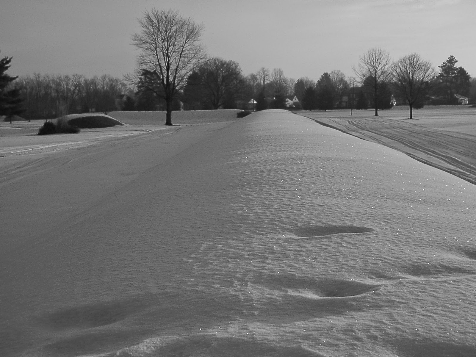 One of the 8 walls of the Octagon with one of the mounds guarding the gateway to the left.
 From the walls of the Octagon, a smaller circle with a serpentine gateway is still well preserved. The circle was at the opening of the Hopewell Road that ran from this spot to Chillicothe, Ohio, 60 miles distant.
 Two parallel earthworks connect the Octagon with the circular earthwork.
 Circular earthwork attached to the Octagon.